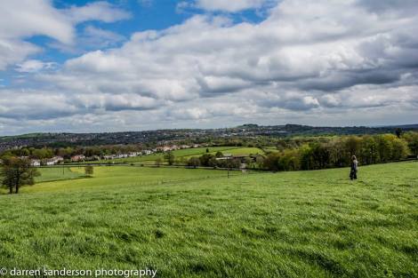
Guiseley Hollins Hill (with cows) – Green Belt Site
Green Belts became planning policy in 1955 to stop unhealthy urban sprawl in industrial areas. The first were put around London and Sheffield. Not all green fields are Green Belt – GB has specific purposes.
Development on Green Belt land is supposed to be tightly controlled so it can fulfil its purposes: to serve as a buffer between towns, and between town and countryside to stop sprawl. This is also an incentive to regenerate damaged and derelict land within the urban areas. Green Belts are supposed to make everywhere better places to live, towns, urban fringe, and country.
These are the 5 specific purposes land has to fulfil to become a Green Belt. Not all green fields are Green Belt.
- to check the unrestricted sprawl of large built-up areas
- to prevent neighbouring towns merging into one another
- to assist in safeguarding the countryside from encroachment
- to preserve the setting and special character of historic towns
- to assist in urban regeneration, by encouraging the recycling of derelict and other urban land
Here is a video from CPRE explaining the purpose of Grene Belt.
Current Government policy on Green Belt is that it must be kept unless there are exceptional circumstances, based on strong evidence, to delete it. Deletion can happen ONLY after all other options for planning have been looked at and considered, and should be done with the approval of local people. Here are some extracts from a debate in Parliament on 6 February 2018 on Planning and the Green Belt.
The NPPF makes it clear that ……. only in exceptional circumstances may a local authority alter the green-belt boundary, after consulting local people and submitting a revised local plan for formal examination.
Green Belt boundaries should be amended only in exceptional circumstances when local authorities can demonstrate that they have fully examined all other reasonable options for meeting their identified housing requirements.”
Leeds City Council want to delete large areas of Aireborough’s Green Belt for housing at

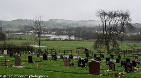
Guiseley Wills Gill – Green Belt Site
Guiseley Ings
Guiseley Hollins Hill
Guiseley Wills Gill
Yeadon Victoria Avenue
You may be interested in what our Landscape Study had to say on these area of Green Belt landscape.
The Council also want the option to delete the following areas of Green Belt in the next few years. It want’s to rename these areas as Broad Locations for housing.
Guiseley Coach Road
Guiseley Coppice Wood
Yeadon Banksfield
Yeadon Gill Lane
Rawdon Leyton Lane
Rawdon Knott Lane
Rawdon Woodlands drive
How Can You Comment On This
- Via the Leeds Site Allocation Plan consultation that is running until the 26th February Details here. You can fill in the Leeds Form, or you can email your views to sap@leeds.gov.uk. Leeds have asked for responses to refer to the plan amendments if possible, and you will find suggestions for how to do that here.
- To local MPs
Stuart Andrew, Pudsey – stuart.andrew.mp@parliament.uk
Alex Sobel, Leeds North West- alex.sobel.mp@parliament.uk
Leeds Brownfield Land Register
Every Local Authority has to keep a register of brownfield land. Here is the register for Leeds, you can also add further sites for consideration.
There is a more detailed post on the consultation and sites here.
Guiseley Ings – Green Belt Site
Yeadon Victoria Avenue – Green Belt Site

You must be logged in to post a comment.