–
Some key links for the Landscape Value Project
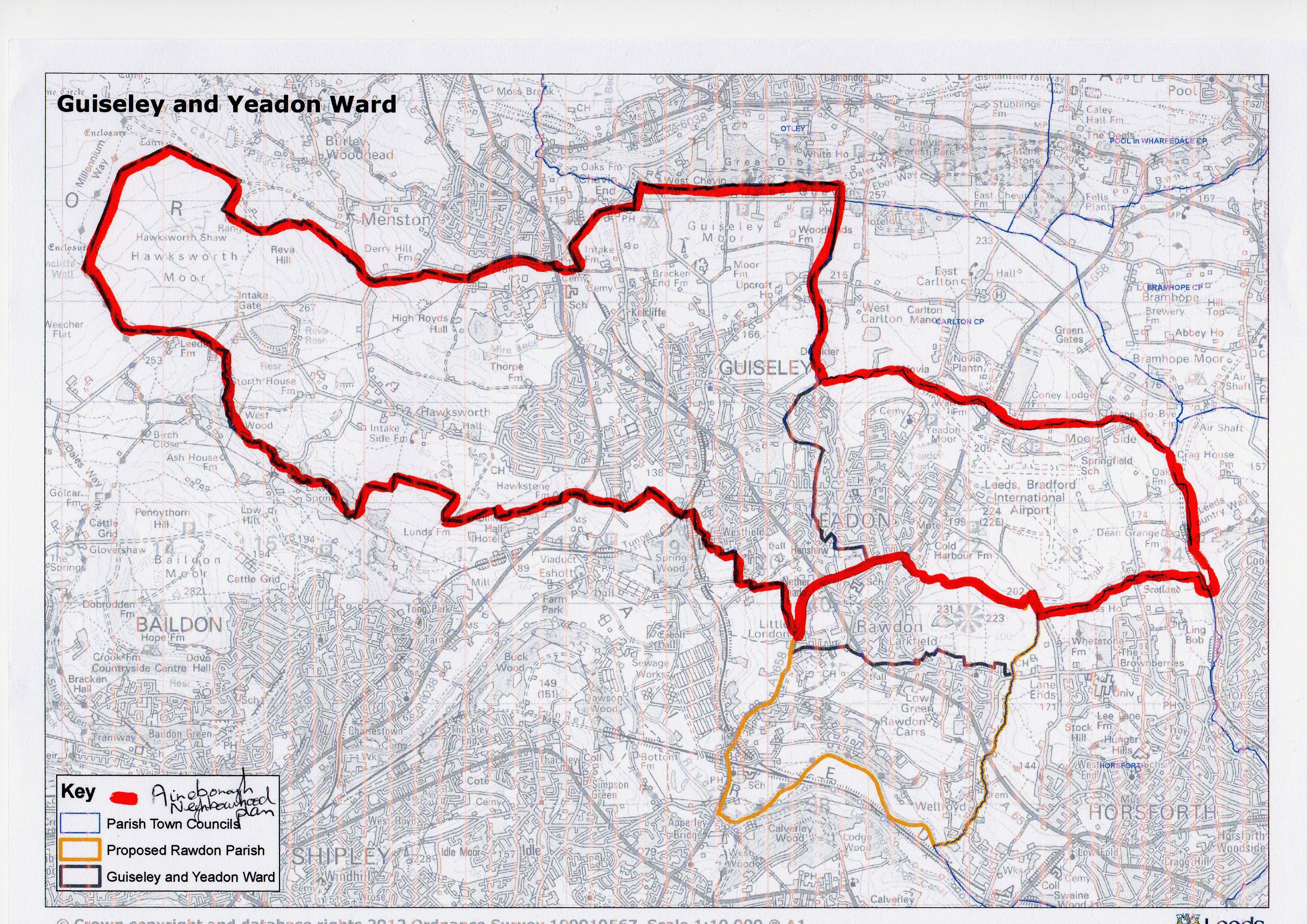
Map of the Aireborough Neighbourhood Plan area with the boundary
Leeds map of Aireborough’s green spaces – this is not up to date, but a good indication
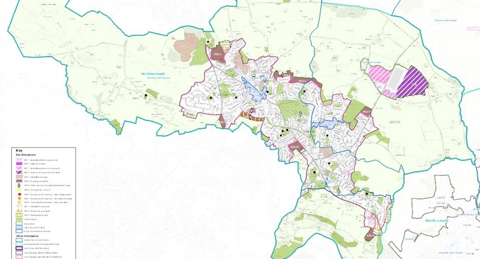
Leeds Aireborough Site Allocations map – with some green spaces marked
Survey forms can be downloaded and printed off for use
Darren Sanderson’s Landscape Photography – ideas for taking good photographs
Link to Streetmap 1:25,000 – click through the levels to find the OS version
Historic OS maping from National Library of Scotland – go to dropdown boxes on the left, select England & Wales, and six inch mapping, hone in to Guiseley/Yeadon/Hawksworth, maps appear on the right from 1847 to 1937 the latter is useful for contours. Click on the map you want, and again hone in to the area you are looking at.
Workshops
- Briefing workshop 12th March 2016 – 1.30pm New Life Church, Yeadon.
- Report back workshop 2nd April 2016 – 1.30pm Guiseley Methodist Church, Oxford Road. Bring pictures (either on a usb stick, or email them to Tom or Jennifer beforehand, surveys and maps).
Frequently Asked Questions
- Should we include large, ‘historic’ private gardens? – this is a judgement out in the ‘field’. Does the garden add, or detract from the look and feel of the area it is in? Is it part of the ‘landscape’ for a variety of people, houses, walkers, cars? Could you imagine that someone may want to build an estate of houses on it? If the garden is of ‘significance’ in these ways, then include it in the survey. If the garden is mostly enclosed, not particularly part of any public realm, or featureless, then do not include it.
- Do we include car parks? – yes, the ones that are significant in the public realm, in the same way as the gardens above.
