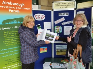
Liz Kirkpatrick with ecology blogger Amanda Peters http://thequietwalker.blogspot.co.uk/
It is a great concern that West Yorkshire Ecology admit that their ecology maps for Aireborough are not up to date, and were last done a good few years ago. The reason being, that the WYE maps are the starting (and frequently ending) point for many ecology reports for development plans.
Therefore, in March the Aireborough Neighbourhood Development Forum, commissioned ecologist Richard Wilson, to firstly undertake a phase 1 study on all key proposed development sites, including the verification of work done in site sustainability reports. This is now complete.
Secondly, we have asked Richard to lead a group of knowledgeable local enthusiasts in exploring areas of potentially valuable ecology, with a view to thinking about what areas should be enhanced, what given a special designation in the Neighbourhood Plan, and how areas link up to form habitat networks. All of this, to eventually feed back into the WYE maps, so they are more comprehensive and up to date.
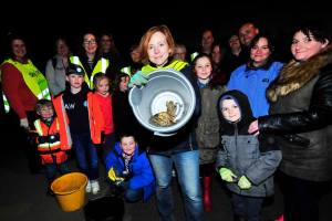
Catherine Burton leads a team of toad catchers on High Royds.
Picture: John Waite, Menston Village Group Facebook page
The second part of the project is due to start in early May, and we are busy recruiting knowledgeable experts – we have already found a number, including professional ecologists, people who blog on the subject, and those who volunteer to undertake surveys in different areas eg spiders, butterflies, insects, botany, birds. Everyone has been extremely helpful, and there seems to be an interest in creating an ecology network, whose first task will be this most important survey.
The task will involve a workshop and training session with Richard on 30th April 10.30am, Guiseley Methodist Church, to ensure that everyone knows how to do a valid ecological survey, that would have weight. This will include a session in the field on observation. Then everyone will choose a small area of potential to monitor once or twice each month in May and June 2016. The areas will include those identified in the Landscape Value survey as needing a more detailed study. The information will then be collated and Richard will verify and underwrite it.
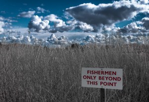
Potiential site spotted by Darren Sanderson on the Landscape Value Project. Picture Darren Sanderson Photography
With so many developers and ecology companies using this information as their baseline, this is a vital project, but it is also important that we can plan areas for conservation and improvement in the Neighbourhood Plan. Aireborough seems to have a wealth of talent, let’s use it. If you are interested in joining the project contact Liz Kirkpatrick on aireboroughnp@gmail.com.

You must be logged in to post a comment.