The planning application for the ex Green Belt site on Wills Gill has now been lodged with Leeds City Council. You can find all documents on the Leeds Planning Portal along with the facility to comment on the proposal by 13 March, is here.

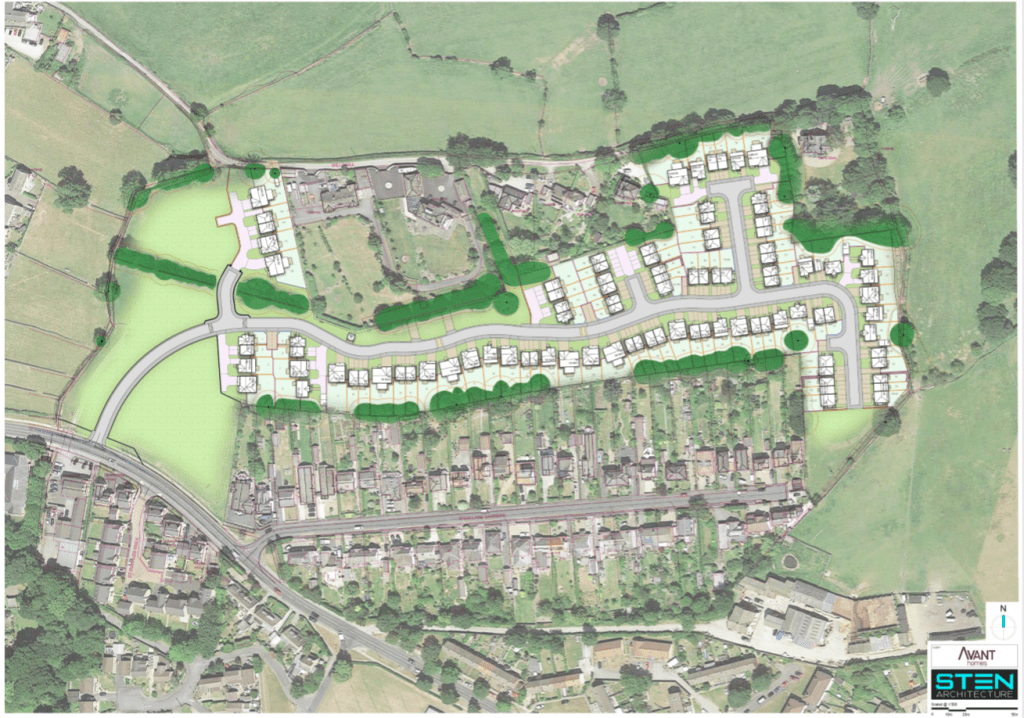
The plan has changed very little from the public consultation held by the developer in October 2019 here.
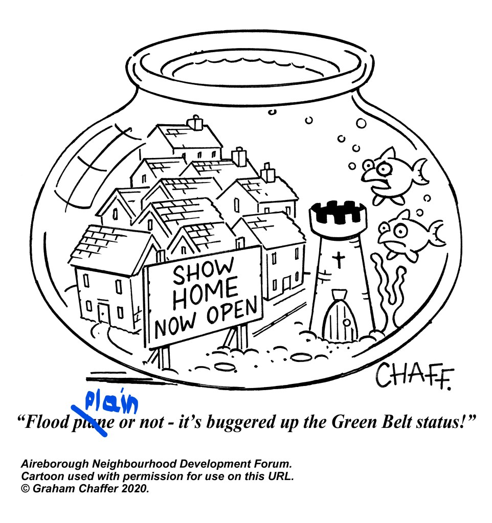
Leeds City Council claimed to the Planning Inspector that Wills Gill was one of the most sustainable Green Belt sites in Leeds for release. They said that any negative factors could be mitigated. It is crucial therefore that plans are scrutinised to offset the negative factors of impact on Guiseley conservation area, flooding and drainage, traffic and congestion.
Green Belt Legal Claim
As many will be aware, this site is one of the 4 Green Belt sites in Aireborough whose development local residents have challenged in a legal claim, via the Aireborough Neighbourhood Development Forum.
The claim was heard in the Royal Courts of Justice last week, 4th and 5th February. The judge will not be handing down a judgement to that claim until at least 27 February, and possibly later.
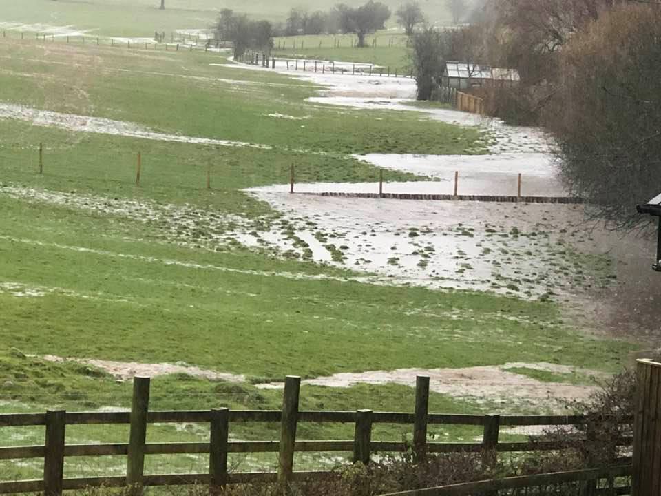
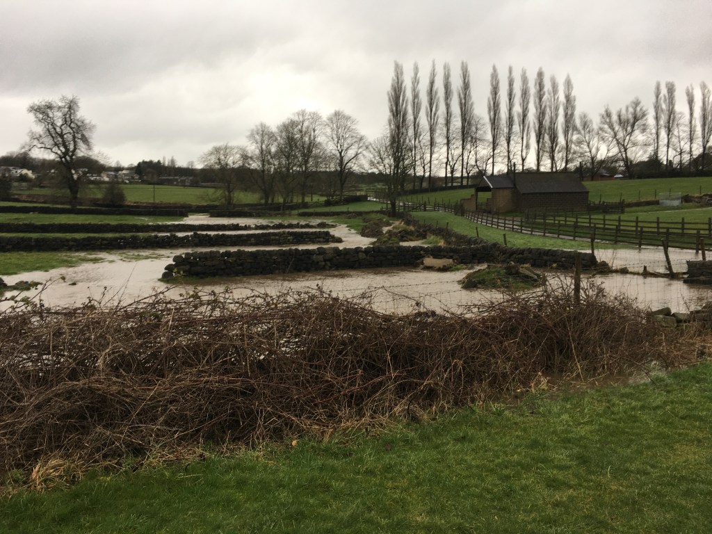
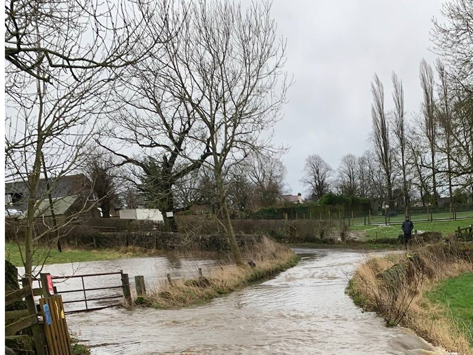
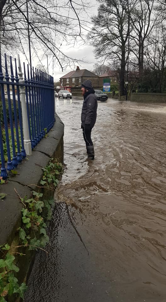
Floods 9 February 2020
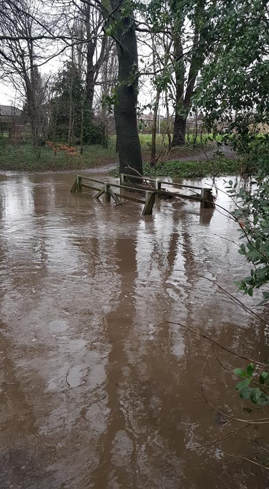
The geology and dip slope of the Chevin collect and act as a natural soak area for rain water. The traditional land use of the whole area was of meadow and pasture which helped manage and control drainage. On Sunday 9 February we saw this landscape demonstrate its drainage function yet again, in a repeat of the floods at Christmas 2015.
The water collected on the Chevin and ran down the becks (and culverts).
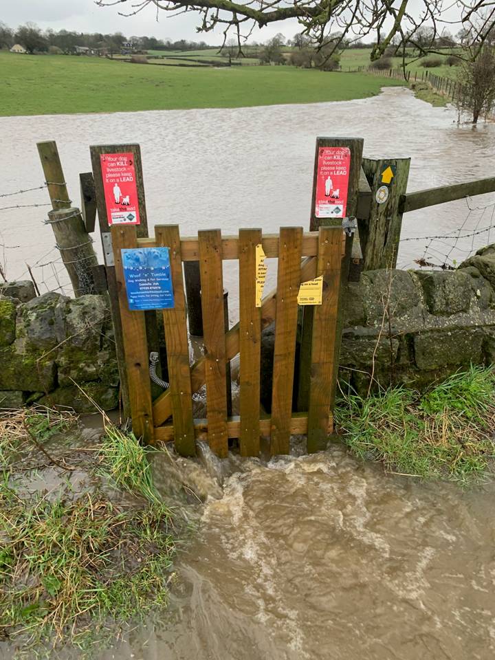
It flooded the medieval tofts and crofts, Wills Gill lane, Carlton Lane and Guiseley Town Street , destroying historic features, road surfaces and getting into cellars and houses.
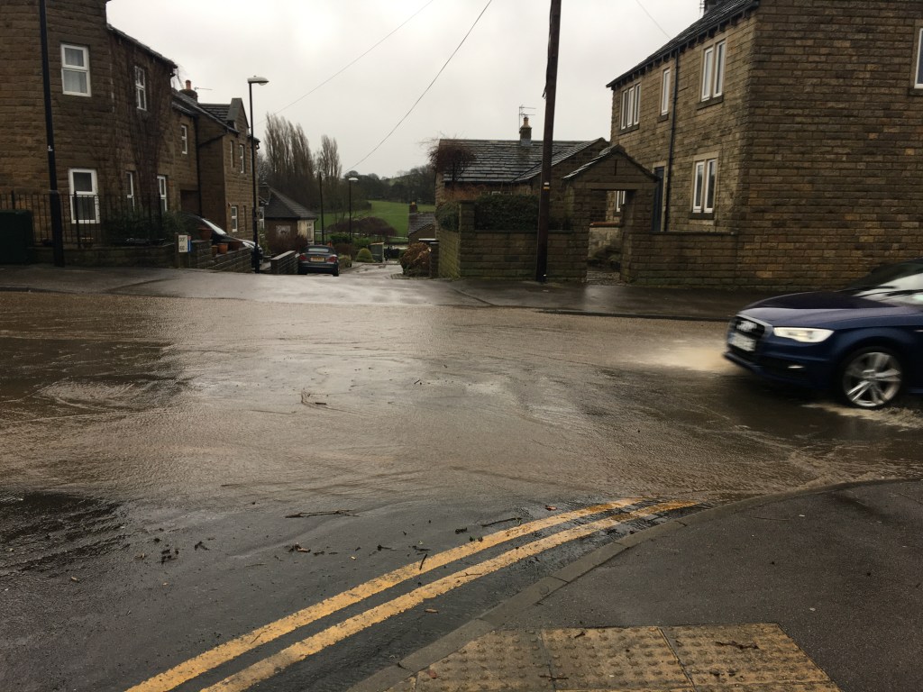
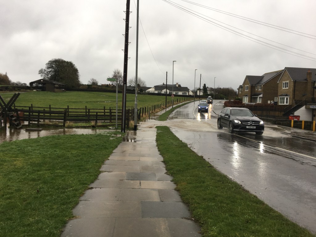
It then flows on to Nunroyd Park, the A65 and the Retail Park , again destroying features in its path
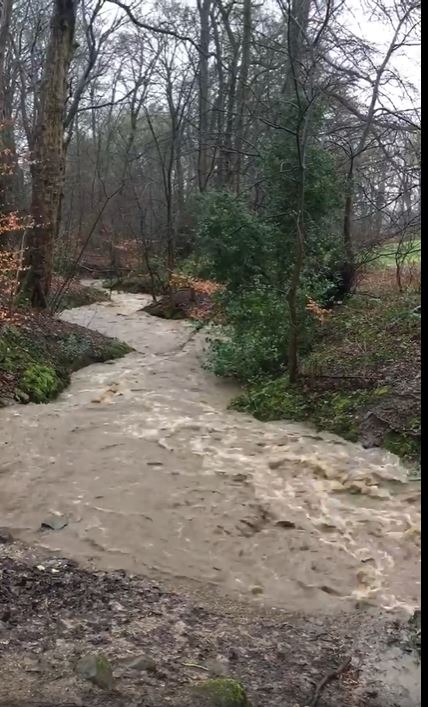

From there the water makes its way down Guiseley Beck Ghyll to endanger Esholt, and flow into the Aire causing flood warnings
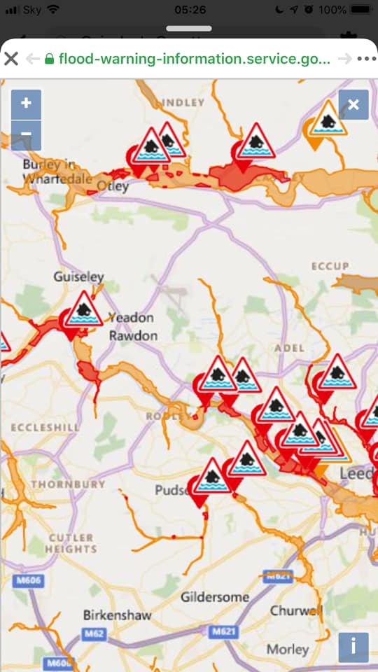
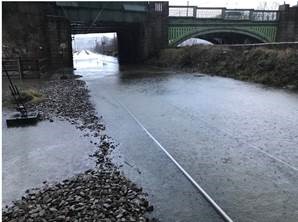
This, then leads to flooding of infrastructure downstream as the Aire flows into the suburbs of Leeds and the City itself. This time Kirkstall railway station was closed. The result of all this is that Leeds City Council wants more money spent for its ‘hard’ flood defences.
On the West Flank of the Chevin, and from Reva Hill, the same story is repeated. With the water ending up in Otley and the Wharfe, with destroyed roads, bridges, railways and infrastructure. Here another ex Green Belt site is due for development, this time the Ings and floodplain for Mire Beck.
With thanks to everyone who sent us their photographs. If you have any further ones that demonstrate the issues please send to aireboroughnp@gmail.com . We have compiled a report and sent to Stuart Andrew MP, as well as the Green Belt Challenge Legal team – for information.
Please do also write to the Council, our local councillors and MPs to express any concerns you may have.
Cllr Judith Blake- Leader LCC judith.blake@leeds.gov.uk
Tom Riordan – CEO LCC tom.riordan@leeds.gov.uk
Cllr Graham Latty – Graham.Latty@leeds.gov.uk
Stuart Andrew MP – stuart.andrew.mp@parliament.uk

You must be logged in to post a comment.