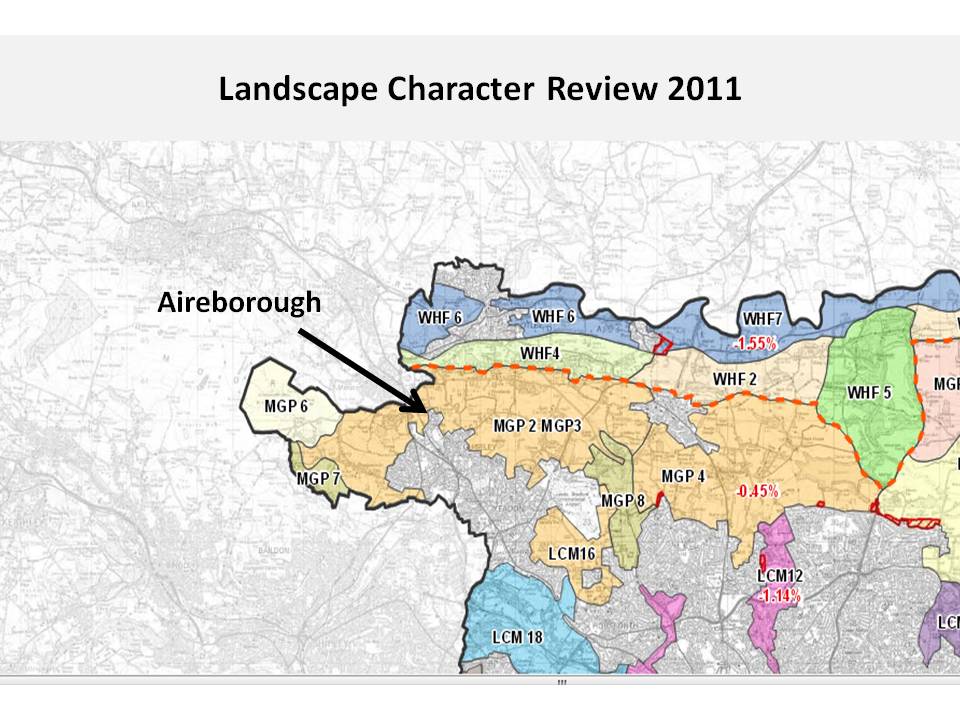
Map link is below, Leeds 2011 Landscape Assessment Maps
The Leeds Site Allocations will be coming out for review sometime later this year. In the Neighbourhood Plan we need to have prepared our sustainability assessments for the area and these sites, in order to give objective evidence about them at both the public consultation and the official examination by a planning inspector. We will be calling on a number of members and affiliates of the Neighbourhood Forum to help in this process; looking at areas such as transport, facilities, and housing need, but here is some background on one key area that is increasing in importance nationally – valued landscape.
Importance of Valued Landscape Rising in Planning Applications
National Planning Policy (NPPF) states that planning should take account of ‘core planning principles’ (point 17). One of those principles is
“to take account of the different roles and character of different areas, promoting the vitality of our main urban areas, protecting the Green Belts around them, recognising the intrinsic character and beauty of the countryside and supporting thriving rural communities within it”
For a number of years since the inception of the NPPF in April 2012, these principles have taken a back seat, to NPPF policy 14 which says there is a ‘presumption in favour of sustainable development‘ . Basically this has meant that development has been given the green light, unless there have been any significant reasons of harm to outweigh the benefit of new housing. As predicted by many, this has led to a large number of legal cases. Judgements in these have been slowly edging their way back to a situation where development has to prove itself ‘sustainable’ first under NPPF 17, before it can be accepted under NPPF 14; but not quite. The Coalition Government 2010 – 2015 have fudged case-law in this area (known as William Davis Principle) and not overtly said that sustainability has to be proved first; rather it is left for different planning inspectors, judges and ultimate the Secretary of State to decide what is harm and what is sustainable, and whether there is a two-step approach or not. All very unsatisfactory.
However, the Principle of valued landscape, or landscape character, does seem to have been strengthened by case-law in a number of appeals recently, including that at Kirklees Knoll in Farsley. Subsequent to this the last Planning Minister Brandon Lewis, in a letter to the Planning Inspectorate on 27 March 2015 gave instructions for this to be taken into account in applications and appeals !!
We are publicising some of these appeal cases more widely,with the help of the Planning Advisory Service, to promote greater understanding of how landscape character can be taken into account by local planning authorities in their decisions. These cases also reflect the wider emphasis on delivering sustainable outcomes at the heart of the Framework, which means taking full account of the environmental as well as the economic and social dimensions of development proposals
Valued Landscape and Aireborough, Especially Site Allocations
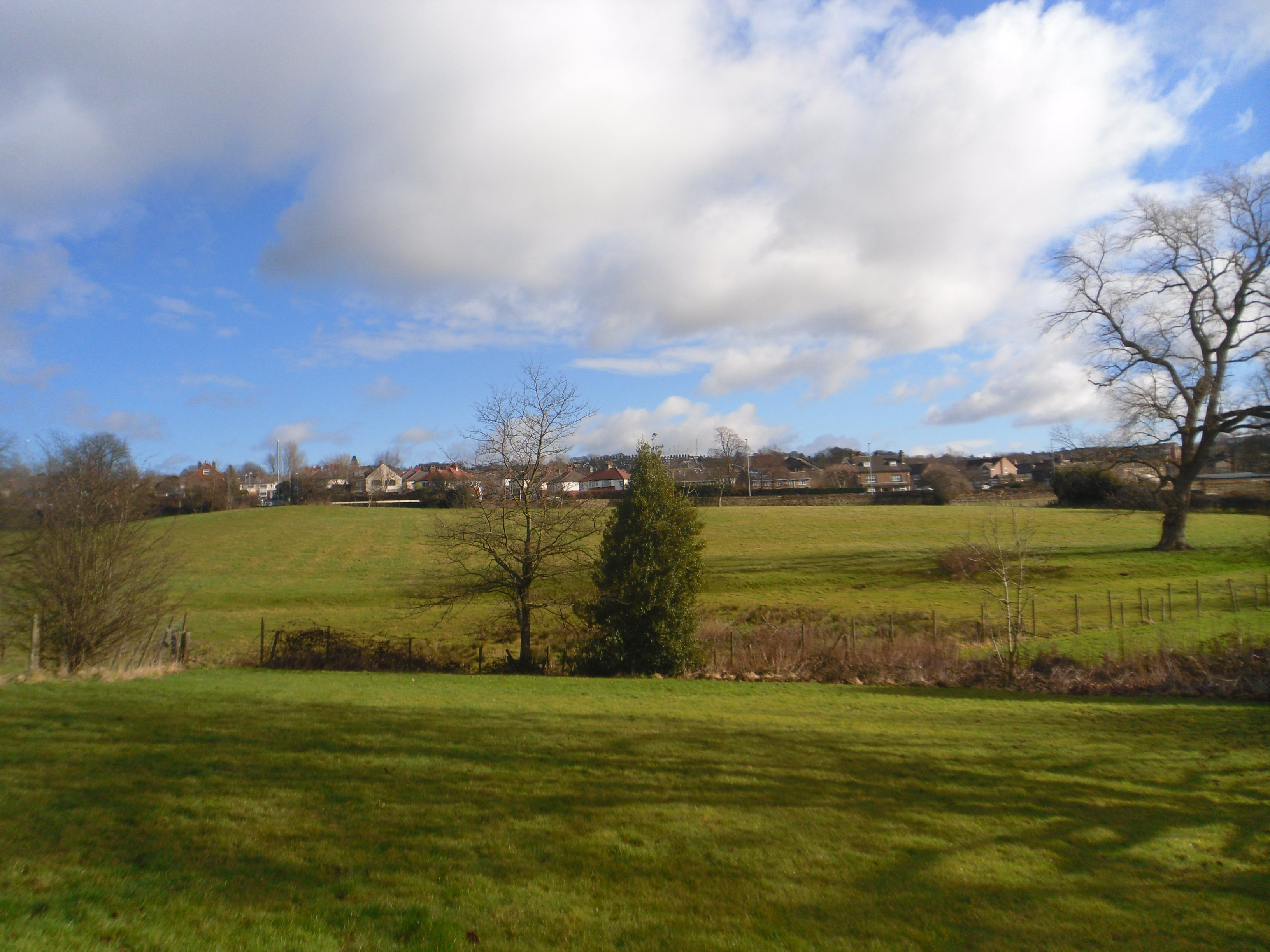
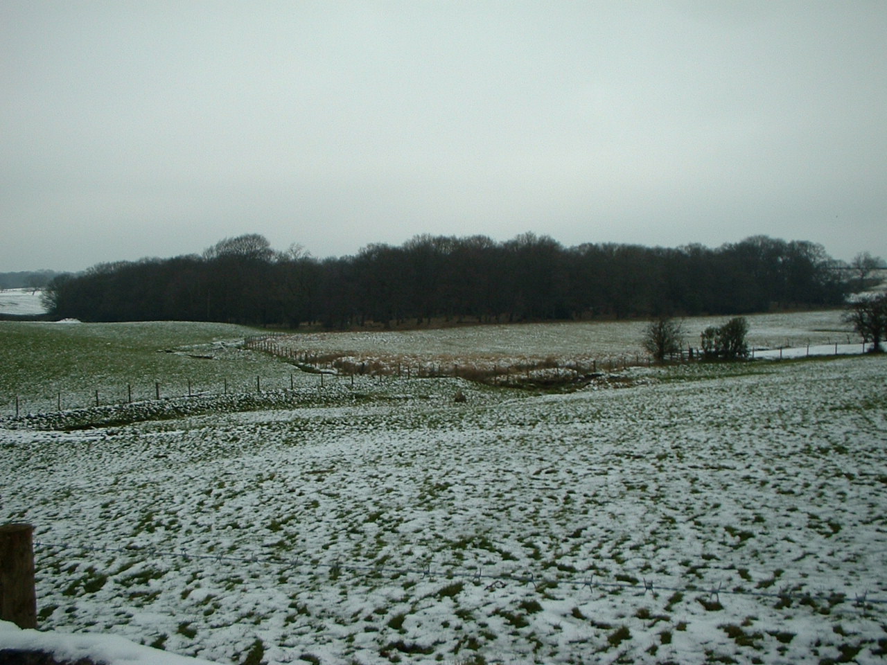
Gill Lane, Nether Yeadon
Thus, when Leeds are looking at their site allocations, they need to be looking at valued landscape and landscape character; and neighbourhood planning groups need to be doing the same. For, this is going to be a key area come public consultation and inspection.
In Airborough we also need to take a look at both the Leeds Landscape Character Assessments, which were done in 1994, but readopted in 2011 Landscape Assessment map here. And also the Bradford Assessments, which were done in 2008′ for Esholt (which affects Nether Yeadon, Coach Road, and Hollins Hill). And Wharfedale, which covers the Menston area and thus Ings Lane. All of these can be found in our reference section here.
As well as describing the character of our landscape, from the Guiseley Plateau, to the Calverley Valley (New Road Side, Rawdon), the reports give management plans.
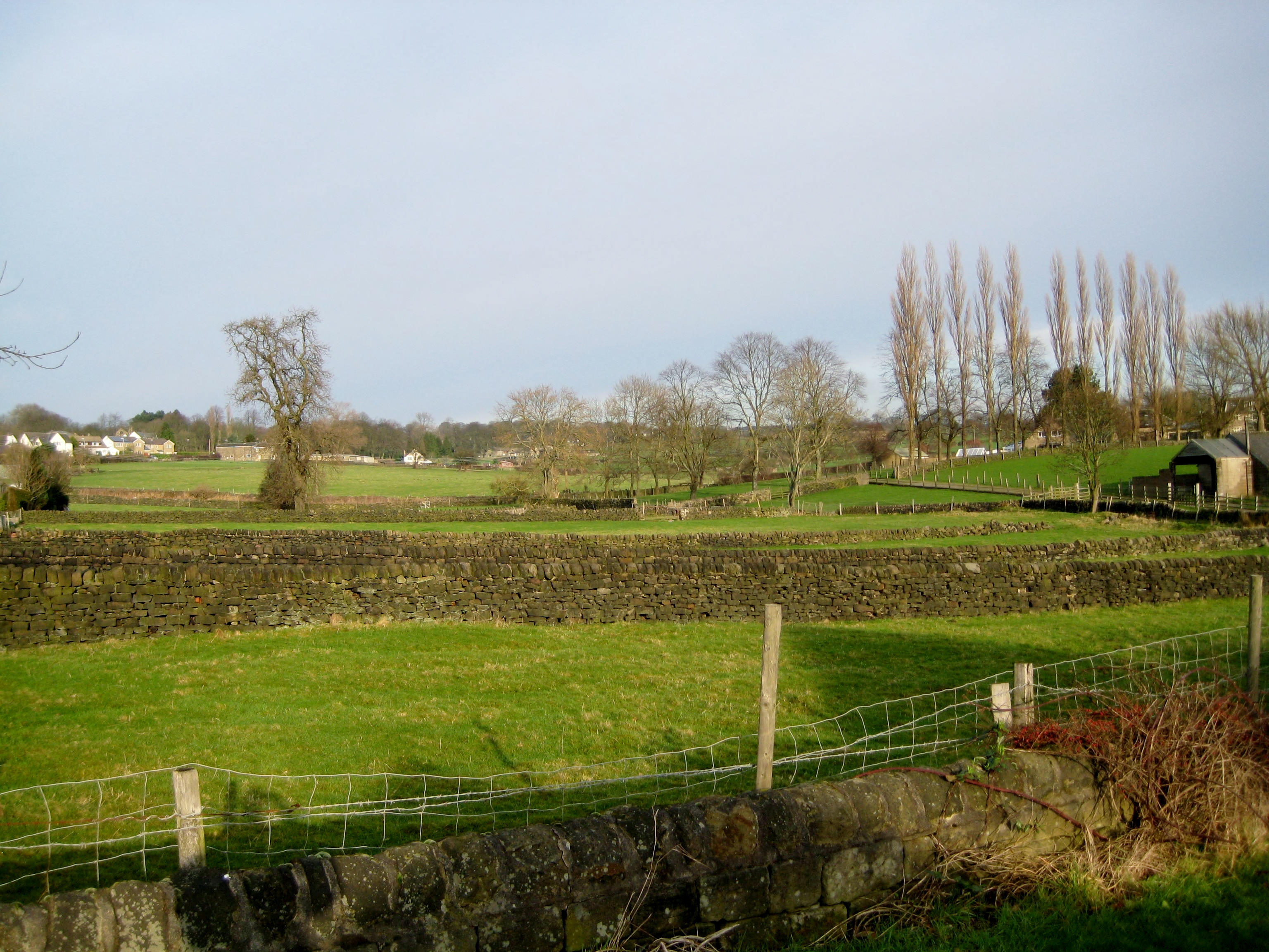
Wills Gill Guiseley
The Guiseley Plateau Assessment (the area to the East of the township of Guiseley and Yeadon on the dip slope of the Chevin), warns against any further suburbanization, and designates the area as one for restoration of character. This affects Wills Gill, and Banksfield site allocations.
The Menston area Assessment of Wharfedale, talks of pasture separating settlements, and the important role it plays in creating a ‘parkland’ setting for the townships and ensuring they are kept as buffers. Also that the edge of the urban areas are screened and softened with woodland in a management plan to conserve and restore. This description also applies to High Royds, and Ings Lane, Guiseley.
The Esholt Assessment for Bradford, which also buffers up to Coach Road, Hollins Hill and Nether Yeadon, talks about this important, and attractive landscape being used to create a sustainable buffer between Leeds and Bradford, and is down to be conserved and restored.
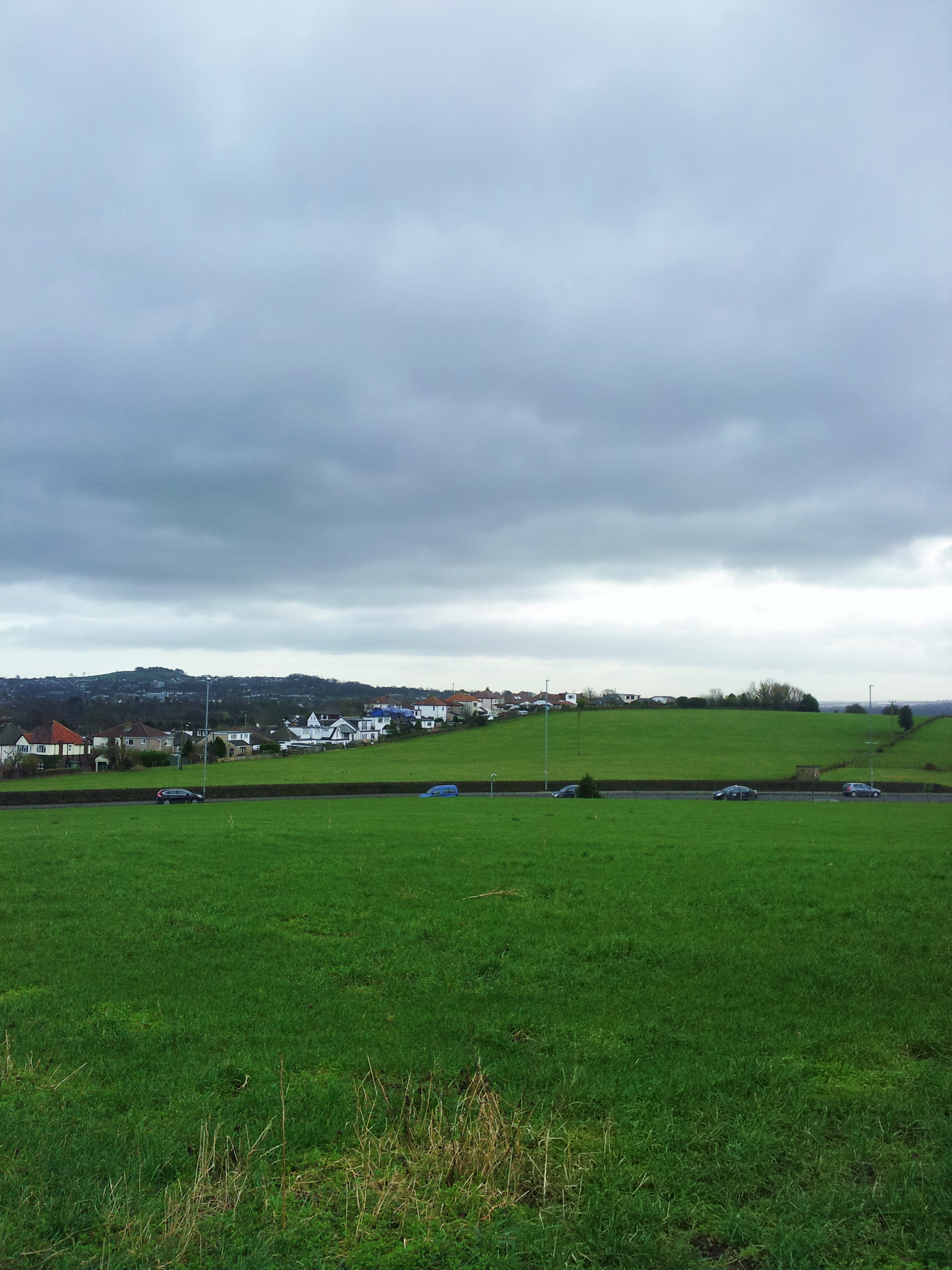
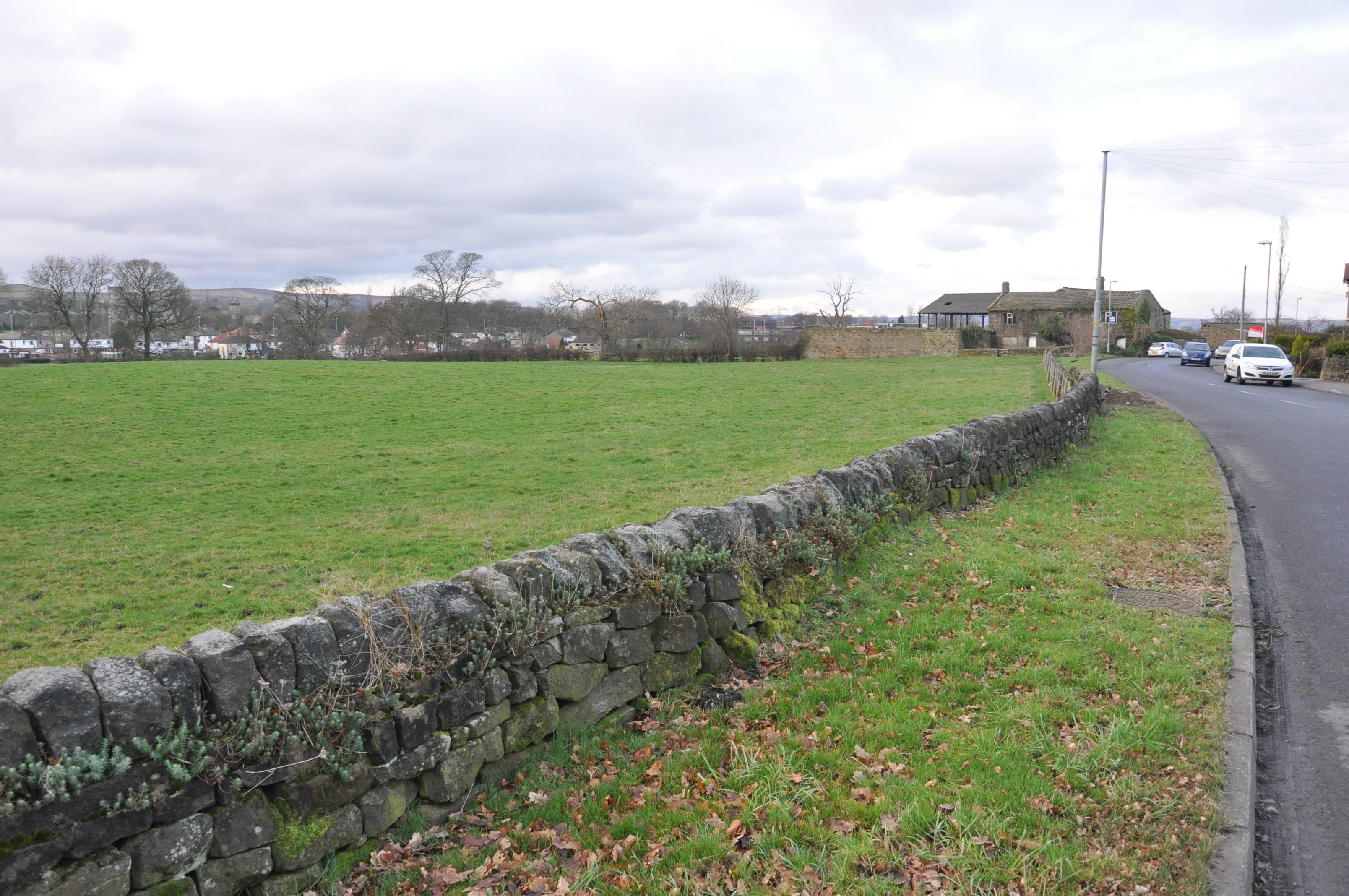
Hollins Hill, Guiseley
Turning to how Leeds have used landscape character in their core strategy, we see at a rather weak Policy P12
The character, quality and biodiversity of Leeds’ townscapes and landscapes, including their historical and cultural significance, will be conserved and enhanced to protect their distinctiveness through stewardship and the planning process.
In addition there is also a statement at point 5.3.48 that talks of development being assessed against conservation area appraisals and management plans for historic landscape; which affects Wills Gill and Nether Yeadon.
We also find on Leeds Core Strategy Map 16 Strategic Green Infrastucture that the Coach Road area is shown as well as that on the Bradford side of Nether Yeadon. And on , Leeds Core Strategy Map 18 Leeds Habitat Network the Ings Lane site is shown – the Ings Lane is also classed nationally as Grade 2 Agricultural Lane (a high rating) – as well as the sites near the Roundabout in Horsforth and Rawdon that are causing a lot of controversy.
All of this diverse information, from the Leeds and Bradford planning documents, needs putting together, enhanced
Banksfield, Yeadon
by the Assessments done for the South Pennines, of which Aireborough is the north east tip. If the Forum, via the Neighbourhood Plan does not do this, then no-one else will, as no other body has an interest in this border area to the extent we all do, who live here. So, we will be sending out emails over the next weeks to ask if you will help with this important work, and play a role in conserving and restoring the distinctiveness of our area.
Ings Lane, Guiseley

You must be logged in to post a comment.