 Leeds cycle map shows recommended routes in some of Leeds, but does not cover the whole area, including Aireborough (current map). West Yorkshire go:cycling have now provided funding for a new map, and this one will cover the whole Leeds district.
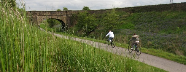
The aim of the cycle map is to provide practical information and recommendations on route choices to help more people to cycle. Many routes on the current map are on roads with no specific facilities for cyclists, the aim is to increase all routes information, including the off road cycle routes on signed and unsigned ways.
The ANF is now supporting the work to co-ordinate cycle route information in Aireborough, as it will also inform the Neighbourhood Plan. So we are inviting local cyclists to contribute information on routes they use in the area – both those that cross and those that are contained in the area.
Information Required
The information needed is on routes that you use for different purposes, and would recommend people use, avoid, or where there are difficulties. We need that information mapped out, with a commentary on use, condition, good points, and issues.
For example, for people from Guiseley wanting to cycle to work in Leeds what routes would you use, and what issues would people face on them (if any). Or, for people wanting to go cycling on a Sunday with a five year old, where could you go, and what facilities would you find on the way?
Specific information required:-
- Routes that are on the carriageway should be shown in blue
- Routes off carriageway should be shown in green
- Points that should be marked as hazardous should be marked with an asterisk and notes
- Lengths that may only be legally used when dismounted (as far as you are aware) should be labelled as such
- Other notes on use eg purpose, facililities, recommendations. That could mean writing down a short diary during or following a journey that would be useful for others to know.
- All routes for the Leeds Cycle Map need to be capable of being ridden by an adult who may have little experience of cycling, but more advanced user routes are also of interest to the Neighbourhood Plan.
Before the routes for the map are used, a specialist team of Leeds Council Officers will examine the routes for safety and their place in an overall network and check legality of all sections of a route. They will also liaise with neighbouring local authorities to link routes for the West Yorkshire Cycle Map.
ANF Cycle Route Team
We are looking for a small team of keen cyclists to work as part of the Forum pulling all the cycle route infomation together for the Aireborough part of the Leeds map, and then using this as evidence for recommended enhancements to cycle routes in the Aireborough Neighbourhood Development Plan. A member of the specialist Leeds cycle route team can provide help and guidance. The closing date for the map information is the end of October 2014, so this needs to be done quite quickly.
If you would like to be part of the team, or you would like to contribute route information please contact aireboroughnp@gmail.com.

You must be logged in to post a comment.